Augustine Volcano


Mount St Augustine (1220m) is a frequently active volcano, the deposits of which form 8x11km Augustine Island in the lower Cook Inlet, 270km SW of Anchorage, Alaska. Augustine essentially consists of a single edifice with a number of overlapping summit domes surrounded by the debris from repeated summit collapses. The Island was named by Captain James Cook, when he reached it on 26 May 1778 (St. Augustines Day). Eruptions have been documented starting in 1812, 1883, 1935, 1944, 1963, 1971, 1976, 1986 and 2005. Many of these are thought to have followed a similar course to the well-documented 2005-2006 eruption.


Augustine Volcano Augustine Volcano

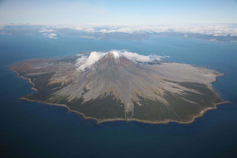
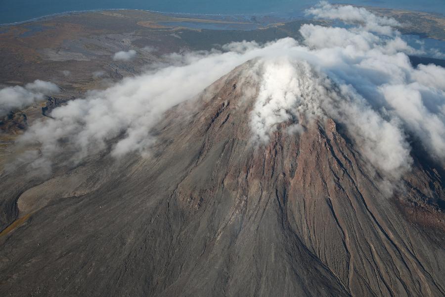
Steaming dome of Mount St Augustine with snowcovered Iliamna volcano in the background. View from SW, Sept. 2007.

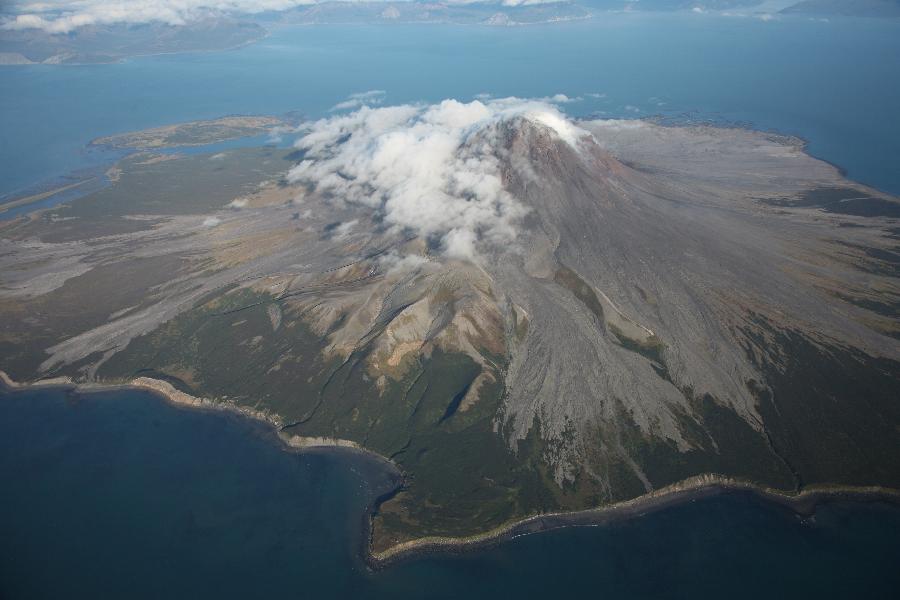
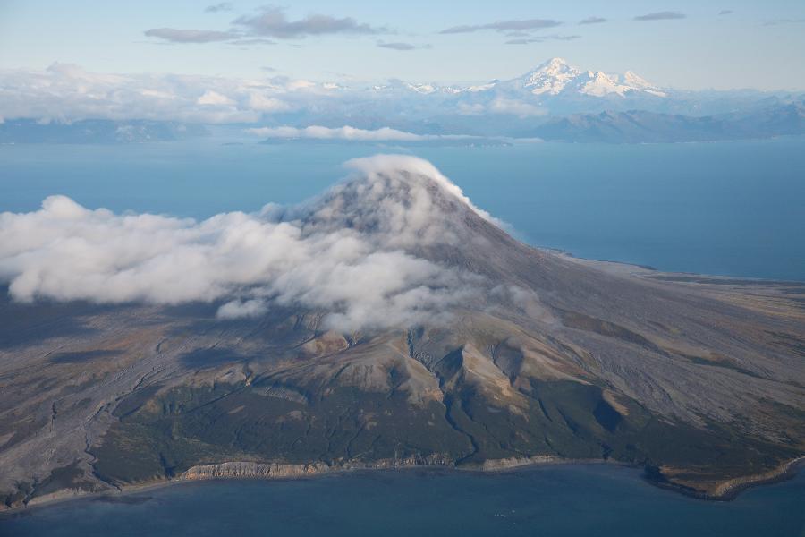
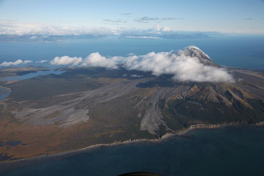
Mount St Augustine with Iliamna volcano in the background. View from WSW, Sept. 2007. Lighter areas represent pyroclastic flow deposits emplaced during the explosive phase of the 2005/6 eruption.


In 2005, thanks to the seismic network emplaced on Augustine Island, it was possible to detect a gradual increase in shallow seismic activity under the volcano in the period from May until early December. Minor phreatic explosive activity commenced by mid-December. The main eruptive activity started following a strong earthquake swarm on 11 January 2006. Two significant explosive episodes resulted in plumes reaching nearly 10km altitude. The columns contained mainly older material, yet subsequent seismic recordings suggested that extrusion of new material was occurring. On 13 and 14 January, six more powerful explosions occurred. These involved more juvenile material and resulted in plumes reaching altitudes of up to 15km. A small lava dome could be observed in the summit on 16 January, some of which was removed by a further eruption on 17 Jan. which resulted in a 13km high ash cloud. This series of explosive eruptions was accompanied by pumiceous pyroclastic flows, and caused numerous avalanches and lahars on the flanks, which were covered in snow at the time of the eruption. After several more distinct explosive eruptions on 28 January, which were accompanied by nearly 10km high ash columns and both pumiceous pyroclastic flows and block and ash flows resulting from collapse of parts of the dome, the volcano entered a phase of nearly continuous ash emission which lasted for about 4 days. This was accompanied by an increasing number of block and ash flows emanating from the dome and associated viscous lava flows. After the intensive ash emissions stopped, the volcano entered an effusive phase which lasted until late March and involved dome growth and the emplacement of two several hundred meter long blocky lava flows on the N and NE flanks. During this final phase of the eruption, it is thought that approximately 30 million cubic meters were erupted.


Augustine Volcano Augustine Volcano

View of Augustine from S. Small peninsula in foreground is South Point which is remnant of debris avalanche 1500 years ago. Top left of island is West Island deposit, top right is 1883 Burr Point deposit.

View of Augustine from SE, Sept. 2007. The nearby coastline of the Alaskan Peninsula is clearly visible in the background.


Due to its remote location on an uninhabited Island, the explosive activity of Augustine poses little direct threat to humans. However, Augustine has repeatedly been the site of large debris avalanches which have not only reshaped the island, but have also resulted in tsunamis which pose a significant threat to coastal communities in the area.

Tsunamis account for around 25% of total fatalities caused by volcanic activity worldwide in the last 250 years (Encyclopedia of Volcanoes, Sigurdsson Ed., 2000). Volcanoes can produce tsunamis by various mechanisms, such as volcano-tectonic activity, subsurface eruptions, aerial shockwaves from powerful explosive eruptions passing over water, and displacement of water by entry of large volumes of volcanic material into the sea.

Geological studies show that the surface of Augustine Island is covered by a number of overlapping debris avalanche deposits. By carbon-dating of the deposits using entrapped biological materials, it has been possible to date them and establish a relatively accurate chronology of flank collapse events in the last 2000 years (Beget and Kienle, Nature 356, p.701-704, 1992). It appears that Augustine has gone through 11 cycles of growth and subsequent flank collapse during this period. The size of these events appears to have been relatively consistent, suggesting that each was preceded by growth of the dome complex to a similar critical size. This can be deduced from the fact that the runout distance of debris avalanches is proportional to the vertical drop distance and displaced rock volume. Runout distances of avalanches with a volume of 0.1 to 1 cubic km, as observed at Augustine are usually between 6 and 11 times the vertical drop. All 11 documented avalanches reached the sea and extended offshore to distances of between 3 and 6km.

The two most recent collapse events at Augustine occurred around 450 years ago, forming the West Island deposit, and in 1883, forming the Burr Point deposit at the N of the island. HIstorical accounts of the 1883 event and resulting tsunami exist and have been compared to mathematical models (Kienle et al., Science 236, p.1442-1447, 1987; Beget and Kowalik, Sci. Tsunami Hazards 24(4), p.257-266, 2006). Little is known about the exact sequence of events at Augustine on 6. October 1883. Eyewitnesses at English Bay (Nanwalek), 80km NE of the volcano, spoke of a great eruption which was followed by a series of 4 approximately 7m high waves. The waves carried away fishing boats and flooded houses near the seafront, yet no fatalities occured. This can be accounted for by the fortunate fact that the eruption coincided with low tide. The tidal range in the area is exceptionally high (about 5m), so the wave was only 2m above the high tide mark. Inspection of the edifice after the eruption revealed a horseshoe crater, typical of flank collapse events, with an estimated volume of 0.5km. More recent underwater studies reveal that the Burr Point avalanche extended 5km beyond the shoreline of Augustine Island.

Based on the volume of the collapse and the bathimetry (underwater topography) of Cook Inlet, mathematical models have been applied to estimate the expected wave height at different points along the shoreline. However, these estimates resulted in several-fold lower wave heights than documented. The reasons for this are unclear. It is possible that the debris avalanche could have been accompanied by an energetic lateral blast (similar to that observed at Mt St Helens in 1980), yet the eruption was only heard about half an hour prior to arrival of first tsunamis at English Bay. Tsunamis would be expected to require 1 hour to reach this point. Other 3rd hand accounts of families overwintering on Augustine Island that year report violent seismic activity ("violent shaking") shortly followed by a violent explosion, heavy ash, pumice and rockfall, and resulting tsunamis. The reliability of the account can of course not be verified, neither is it clear whether this explosion was the same as that heard at English Bay or whether the seismic activity was attributable to flank mobilization. The ability of even a relatively small volume collapse to produce a tsunami was demonstrated at Stromboli volcano in 2002.

Whatever the cause, it is clear that 7m high waves could cause substantial loss of life if they reached Homer, which is only about 100km NE of the volcano. Homer's glacial spit, which is full of tourists in the summer months, would be completely overflowed by such a wave. A warning time of just over an hour may not be sufficient to evacuate the area.


Augustine Volcano Lava Dome Complex Augustine Volcano Lava Dome Complex Augustine Volcano Lava Dome Complex

Lava dome complex viewed from NW. Block flow from 2006 eruption is visible on upper flank (middle of image)

S Flank of Augustine lava dome complex, Sept.2007. Extensive erosion has occurred to this old part of the complex.

E Flank of Augustine dome complex, Sept.2007. Lagoon is visible in background.


The frequent recurrence of flank collapses at Augustine can be accounted for by its unusually high output over the past 2000 years. This surpasses similar subduction zone volcanoes by over 10-100 fold. It is thought that 2-3 cubic kilometers of material were erupted from Augustine in the last thousand years alone. The present summit is considered to have reached a critical size, basically filling the 1883 collapse zone. It thus seems that the next collapse event is only a matter of time. A collapse could be triggered by eruptive activity, or by a simple gravitational failure of the edifice. This could be triggered by one of the large earthquakes that have in the past affected the area.

Due to its remote location, Augustine is rarely visited by tourists. During eruptions, the island is usually off limits to the public. On clear days, Augustine can be observed well from the coastline of the Alaskan Peninsula 10km to the NW of the island. Alternatively, small aircraft charter from Homer can be used to view the volcano.


For information on further Alaskan volcanoes, see sections on Shishaldin, Douglas and Fourpeaked.


Photovolcanica Full Index