Deception Island Volcano


Horseshoe-shaped Deception Island is a massive caldera that resulted from the collapse of a large stratovolcano, followed by flooding of the resulting crater through a breach in the caldera walls at Neptune's Bellows. Following formation of the caldera, numerous smaller eruptive events have modified the landscape at a variety of different sites. The Island has an approximate diameter of 14km, with the water-filled caldera known as Port Foster extending for up to 8 x 10 km. The current maximum depth of the caldera is less than 200m as a result post-caldera sedimentary processes. Several models have been proposed for caldera formation (see e.g. Baraldo and Rinaldi 2000. J. S. Amer. Earth Sci. 13, p.785-796). The simplest model is the collapse of a large pre-caldera stratovolcano following emptying of the magma chamber during a massive pre-historic eruption. The perimeter of the caldera is defined by a circular fault zone which has recently been the site of renewed volcanic activity.

Historical eruptions have been reported in 1842, 1967, 1969 and 1970, although at least further eruptions must have occurred between 1829 and 1956 since several new volcanic features formed during this period but activity was not observed. The 1967-1970 activity involved a number of vents near the N shore of the caldera and two fissures above Pendulum Cove and on Mount Pond. Eruptions from these fissures destroyed the Chilean base and resulted in lahars which damaged the British base in Whaler's Bay.


Deception Island

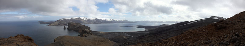
Stitched Penorama: View over Whalers Bay (center), with Neptune's Bellows to left and Mt. Pond to right


Historical eruptions have been reported in 1842, 1967, 1969 and 1970, although at least further eruptions must have occurred between 1829 and 1956 since several new volcanic features formed during this period but activity was not observed. The 1967-1970 activity involved a number of vents near the N shore of the caldera and two fissures above Pendulum Cove and on Mount Pond. Eruptions from these fissures destroyed the Chilean base and resulted in lahars which damaged the British base in Whaler's Bay.


Deception Island

Deception Island

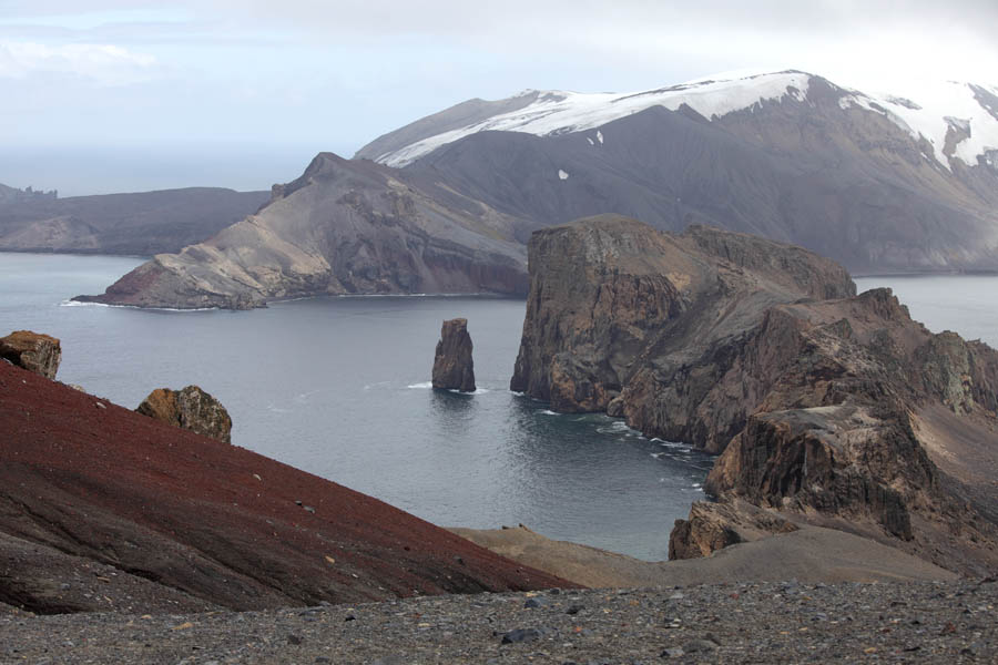
Neptune's Bellows - Entrance to Caldera

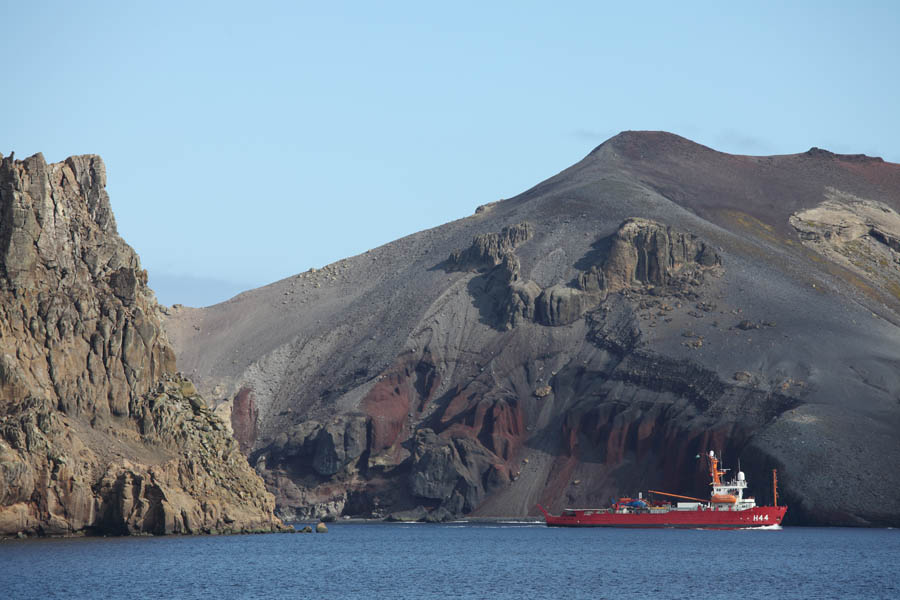
Ship entering Caldera. View from Whaler's Bay


Deception Island

Deception Island

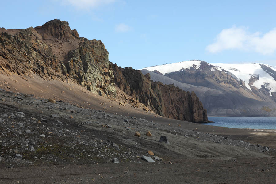
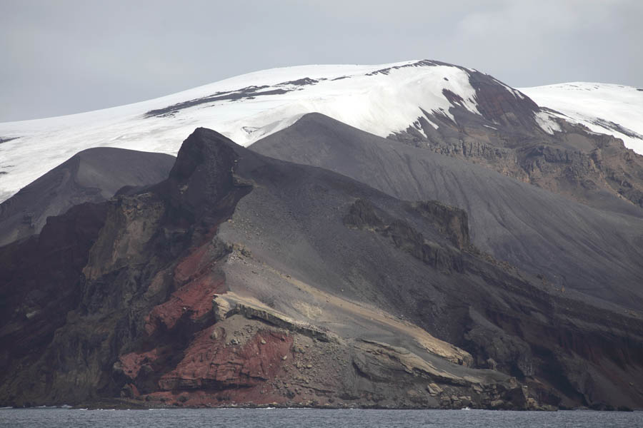
Southeast Point - Outer Flank of Deception

N. Flank of Neptune's Bellows viewed from Whaler's Bay


Since even large ships can enter the caldera through Nepune's Bellows, it has long provided protection from the often stormy waters of the subantarctic / antarctic region. The caldera was frequently used from 1821-1825, when the South Shetland Islands Fur Seal population was exploited to the verge of extinction. The island was first charted in 1828-29 by Henry Foster of the HMS Chanticleer. Magnetic observations and pendulum studies were made, explaining the name Pendulum Cove given to one of the small bays. From 1906 to 1931, the whaling station at Whaler's Bay provided a base for numerous vessels operating in the area and was the most southerly permanent station. A small runway was operational near Whaler's Bay in 1929 and the remains of a Hangar can still be seen. During WWII, the british Royal Navy policed the area and a small base was established. Scientific bases were established by several nations since the 1950s, but the british and chilean bases were destroyed during the 1967-70 eruptive episodes and not rebuilt (Roobol 1982. Br. Antarct. Surv. Bull. 51, p.237-245).

During the southern hemisphere summer, the Island is now visited almost daily by tourist vessels operating cruises in the antarctic peninsula area. Most vessels disembark passengers at Whaler's Bay where they may view the remains of the whaling station or walk to a view-point above Neptune's Bellows. Another popular activity involves digging a small hole in the sand at the shore and bathing in the warm geothermally heated waters that fill it. Many areas in the caldera are off-limits to visitors, including the most recent eruptive vents, since they are designated as sites of special scientific interest.


Deception Island Deception Island Deception Island

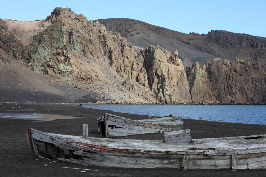
Old wooden boats, Whaler's Bay

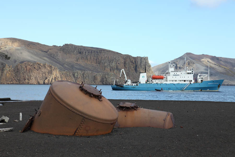
Remnant of Whaling Operation

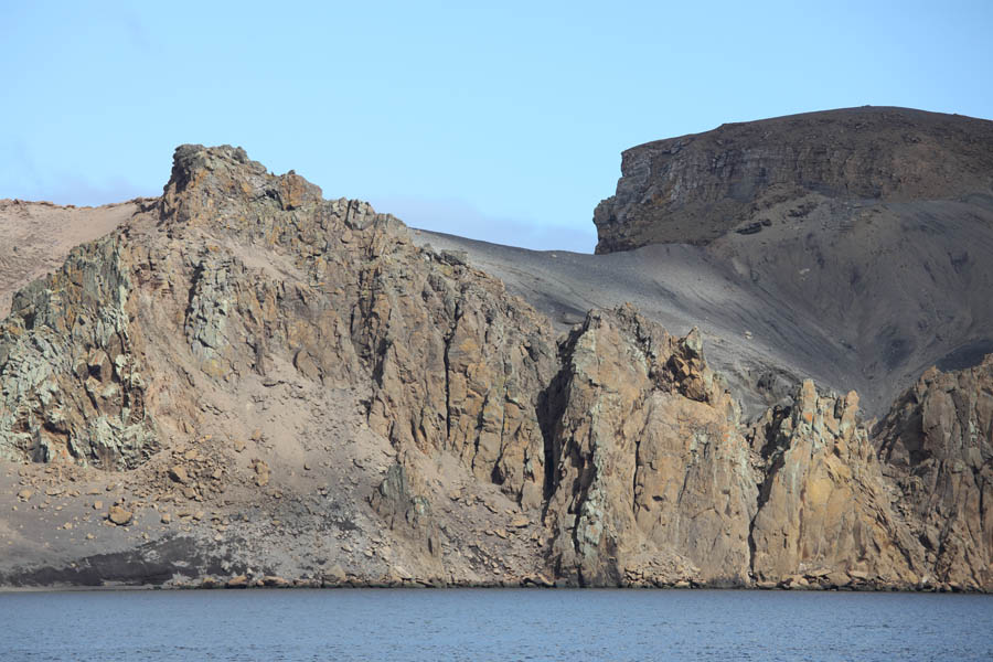
N. Flank of Neptune's Bellows - Inner wall


Deception Island Deception Island

Prof. Molchanov anchored in Whaler's Bay

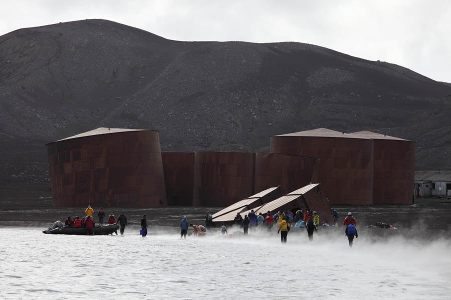
Tourists on geothermally heated beach


Deception Island Deception Island

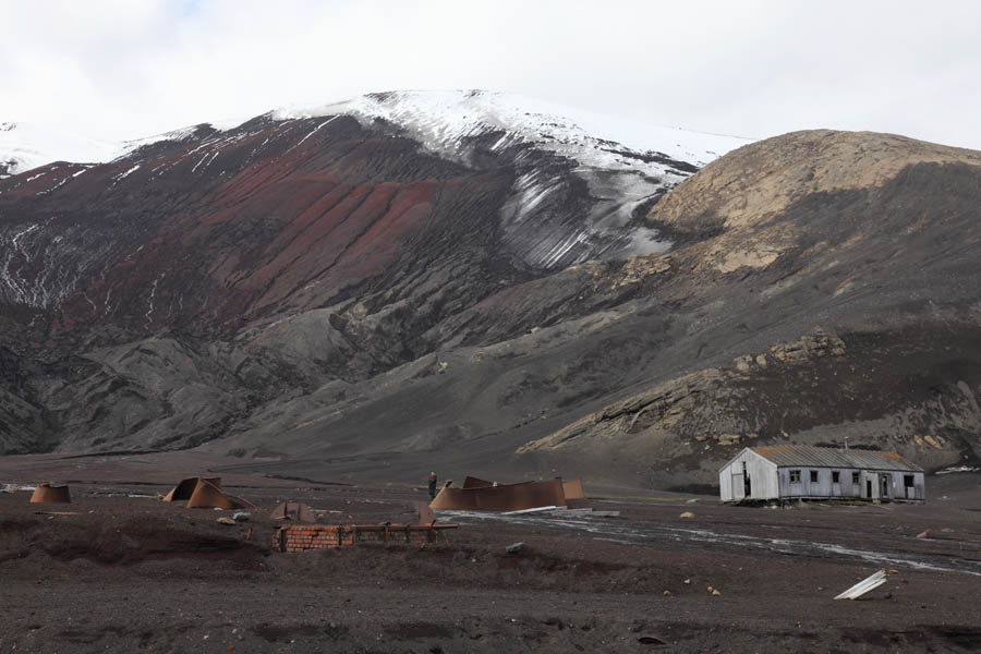
Remnants of Whaling Operation

Remnants of British Base


Deception Island Deception Island Deception Island

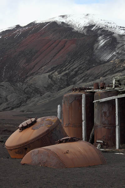
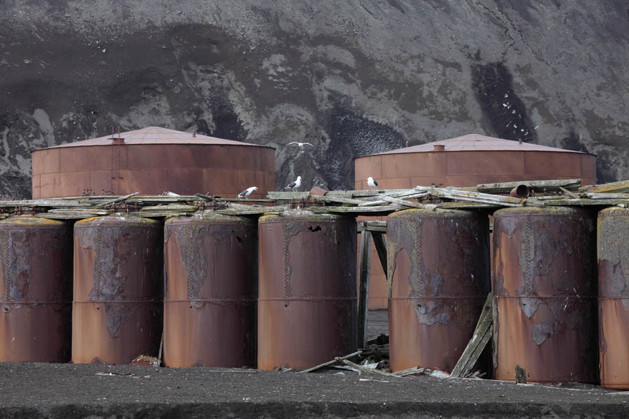
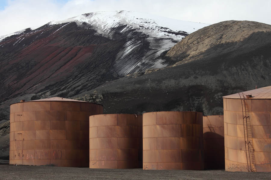
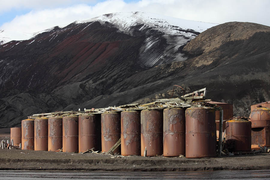
Old Whale Oil Storage Tanks

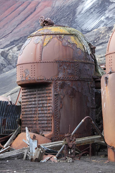
Old Cooker from Whale Oil Production Plant

Tanks from Whale Oil Processing Facility


The Island also provides a home for wildlife, with a number of large Chinstrap Penguin colonies being located on the outer rim. A particularly large colony is located near Baily Head. Gentoo Penguins, Macaroni Penguins, Fur Seals and a variety of bird species also find a home at Deception. The ecosystem of Port Foster has been subjected to extensive study (see e.g. Smith et al. 2003. Deep-Sea Research II 50, p.1595-1609 and references therein).


Deception Island

Deception Island

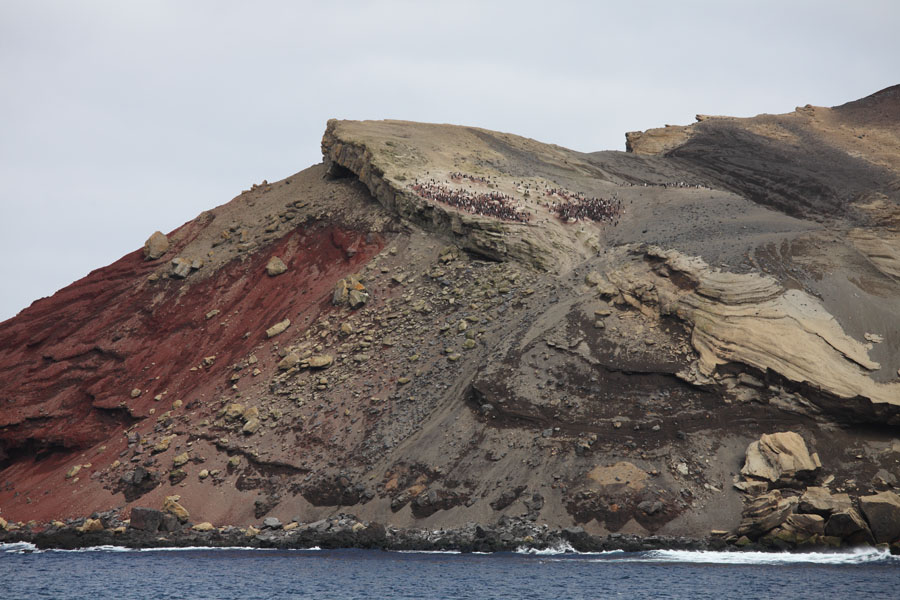
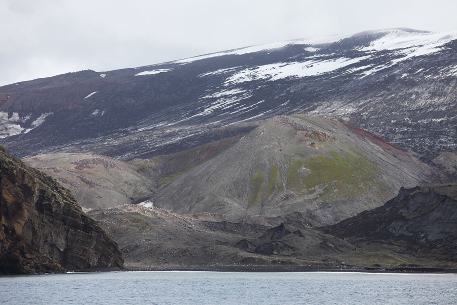
Old cinder cone near Baily Head. Main Chinstrap Penguin Colony

Neptune's Bellows, "Entry Point". Note small Chinstrap Penguin Colony.


Deception Island

Stitched Panorama of Deception Island viewed from the West


Photovolcanica Full Index