Momotombo Volcano


Momotombo volcano is located on the north shore of Lago de Managua, Nicaragua. Its majestic conical edifice is 1297 meters high and capable of powerful explosive eruptions with heavy ashfall but also effusive phases. In 1610, the old city of Leon SE of Momotombo was abandoned after a series of major earthquakes. These were the final straw for the population followed the destruction caused by a massive eruption only four years earlier, where ash had buried much of the city (note: many conflicting sources of information on exact sequence of events). Further notable eruptions occured in 1886 and 1905. The volcano reawakened with a minor explosive event on 01. Dec. 2015 and the images shown on this page document ongoing minor explosive activity in February 2016. The geological setting of the volcano is relatively well studied as a major geothermal power plant has been constructed at the southern foot of the volcano. The Momotombo volcanic complex lies on the Central American Volcanic Graben and is constituted by several small volcanic cones and a central caldera. Mount Momotombo lies on the eastern edge of a 4.5km diammeter caldera known as Monte Galan caldera. A 525m high cinder cone, Cerro Montoso, is found on the NW rim of the caldera. Further old cinder cones are found 1.5km NW of Cerro Montoso (Cerro Colorado, 225m) and 3km S of the latter (Loma La Chistata, 145m). SE of the main Momotombo edifice is a small plateau (Loma La Guatusa) formed by andesitic lava flows and tuffs from Momotombo. Further, the small basaltic island of Momotombito is found rising 350m out of lake Managua about 3.5km offshore to the SE of the Momotombo edifice. Thanks to geothermal exploration, the stratigraphic column is well documented. The volcano has largely emplaced andesitic deposits, although dacite and basalt have been found.

Historical eruptions of Momotomba have taken place in 1524 (VEI 3), 1578, 1605-1606 (VEI 4), 1736, 1764, 1849, 1852, 1854, 1858, 1870, 1878, 1882, 1886, 1902 and 1905. All are rated as VEI 2 eruptions of largely strombolian nature, except where noted (Smithsonian GVP). The 1886 and 1905 eruptions were associated with emplacement of lava flows on its flanks, in the later case extending 4 km to the northeast.

The present eruption (2015-2016) has involved sporadic explosive activity and ash venting, construction of a small lava dome and the emplacement of a lava flow on the NE flank of the volcano, reaching a length of about 2km on 3. Jan. 2016.


Explosive eruption Momotombo Volcano, Nicaragua

Ash cloud from explosive strombolian eruption of Momotombo Volcano, Nicaragua

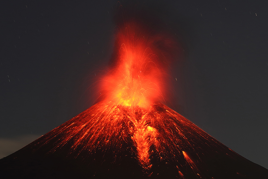
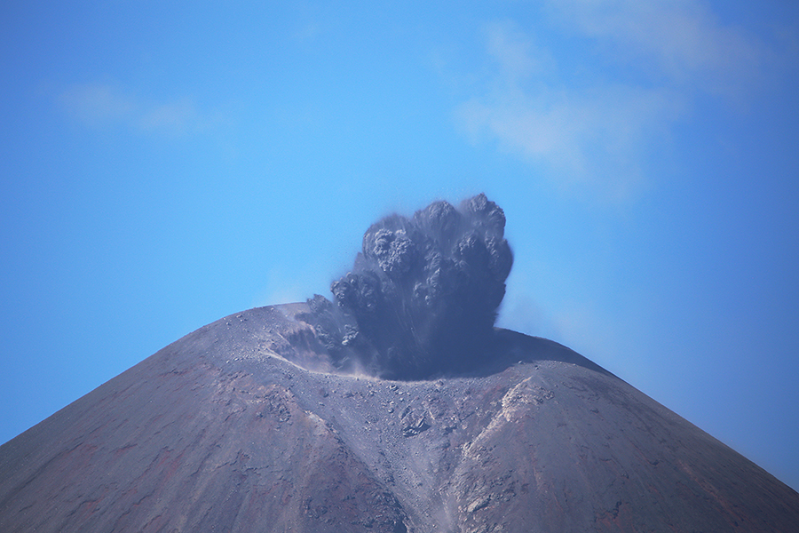
Explosive eruption expelling volcanic bombs and ash, 21.02.2016 (1/2)

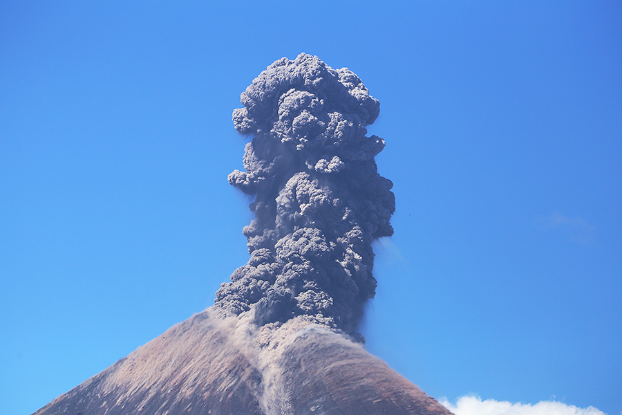
Ash cloud from explosive eruption on morning of 21.02.2016 (2/2)


Nighttime strombolian eruption of Momotombo volcano, Nicaragua Ash cloud and minor strombolian activity following large nighttime strombolian eruption of Momotombo volcano, Nicaragua

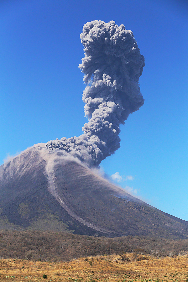
Explosive eruption early on 21.02.2016 (1/2)

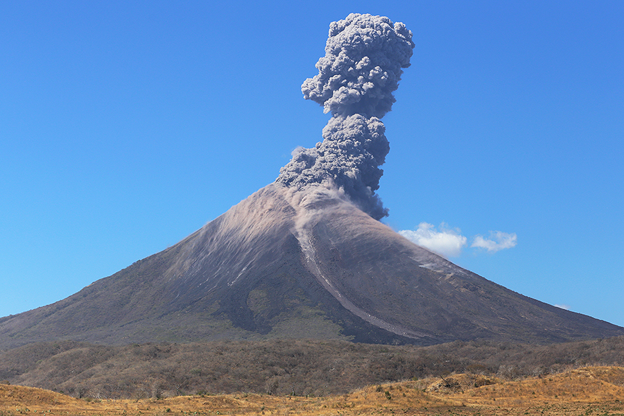
Explosive eruption early on 21.02.2016 (2/2)


EXPLOSIVE ERUPTIONS OF MOMOTOMBO AT DAY AND NIGHT (TIMELAPSE):


Since its last eruption in 1905, Momotombo had maintained strong fumarolic ctivity in the summit crater. Fumarole temperatures of about 230'C were found in 1973, rising to 800'C in 1980 and 904'C in 1986 (Quisefit et al. 1989. Geochim. Cosmochim. Acta 53, p.2591-2608). Gases were rich in water vapour and carbon dioxide. The high temperature gas phases found within the edifice are linked to the active hydrothermal system under the volcano which has made its exploitation as a source of geothermal energy possible.

The Momotombo geothermal power plant was put on line in 1983 after a period of exploratory and preparatory drilling of wells. The site was operated under concession from 1999 by ORMAT Momotombo Power Company. The site is owned by the Nicaraguan Electric Company (ENEL). For information, one can view publications of the power company or a number of scientific papers such as Porras et al. 2007 (Geothermics 36, p.304-329). By 2007, wells had been drilled up to a depth of nearly 3km and in locations from the lake shore to about 200m up the south flank of the volcano. Temperatures of up to 320'C were found in some of the deepest wells. In 1983, the power plant produced about 35MWe using a flash steam unit connected to an array of wells. A second identical unit was installed in 1989 and power output in 1990 peaked at about 70MWe (about 30% of Nicaraguas power consumption at that time). This second unit however led to problems with overexploitation such as well cooling, steam flashing (due to dropping well pressures), cold water intrusion and calcite scaling and necessitated a field rehabilitation program starting in 1999 since power output had fallen to as low as 10MWe by this time (Porras 2008. Geotherm. Training Prog. 30th Anniv. workshop, Reykjavic 2008). A further 7MWe binary cycle unit using lower temperature waters was installed in 1999. The plant has been producing about 30MWe from 2002-2008 (later figures not analysed herein).


NE flank lava flow area, Momotombo volcano Detail of lava flow deposits, Momotombo volcano Detail of lava flow deposits, Momotombo volcano, Nicaragua

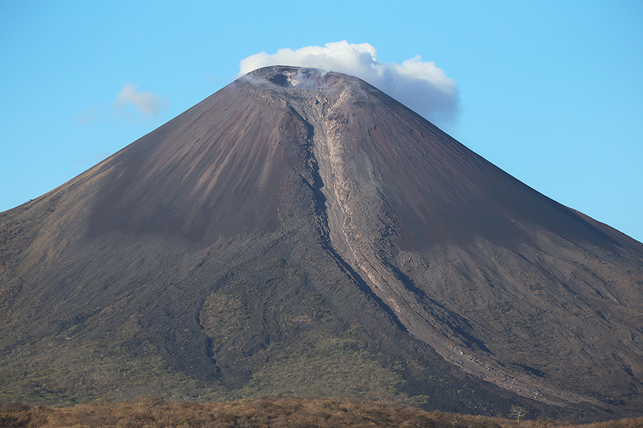
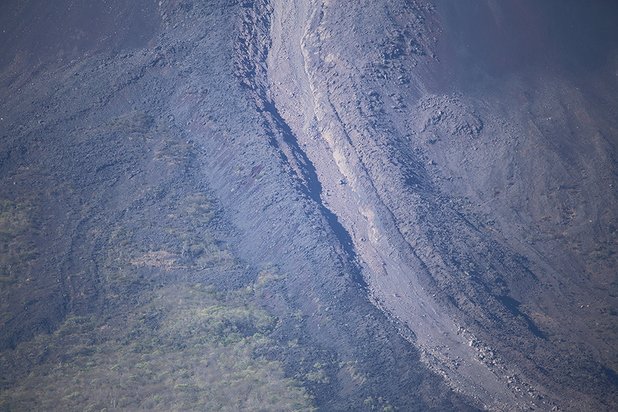
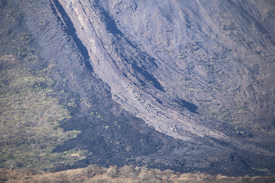
Ravine down NE flank was already visible prior to eruption (presumably associated with 1905 flows) and channeled flows from the crater

Path of main lava flow during late december 2015

Note: light-coloured minor PF deposit in channel


Landscape shot of Momotombo volcano, Nicaragua Crater of Momotombo volcano in February 2016 Momotombo volcano degassing

View from northeast, El Candon area
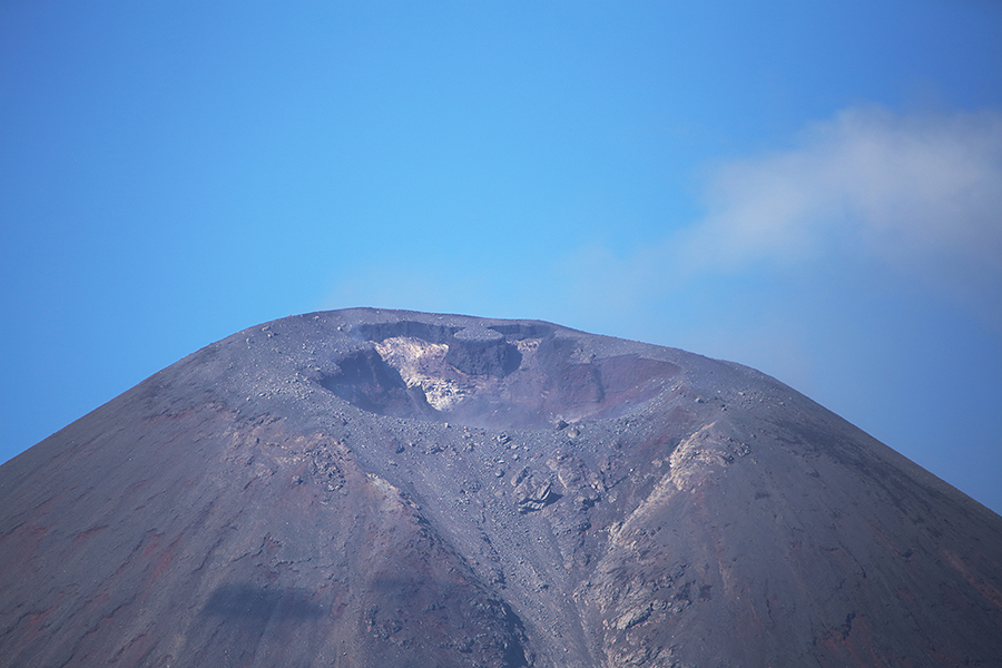
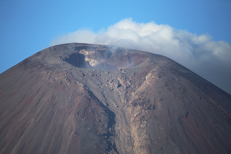
Summit crater

Summit crater with minor degassing


Summit crater of Momotombo volcano degassing between eruptions Strong degassing, Momotombo volcano Minor ashing from Momotombo volcano summit crater

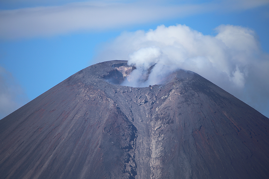
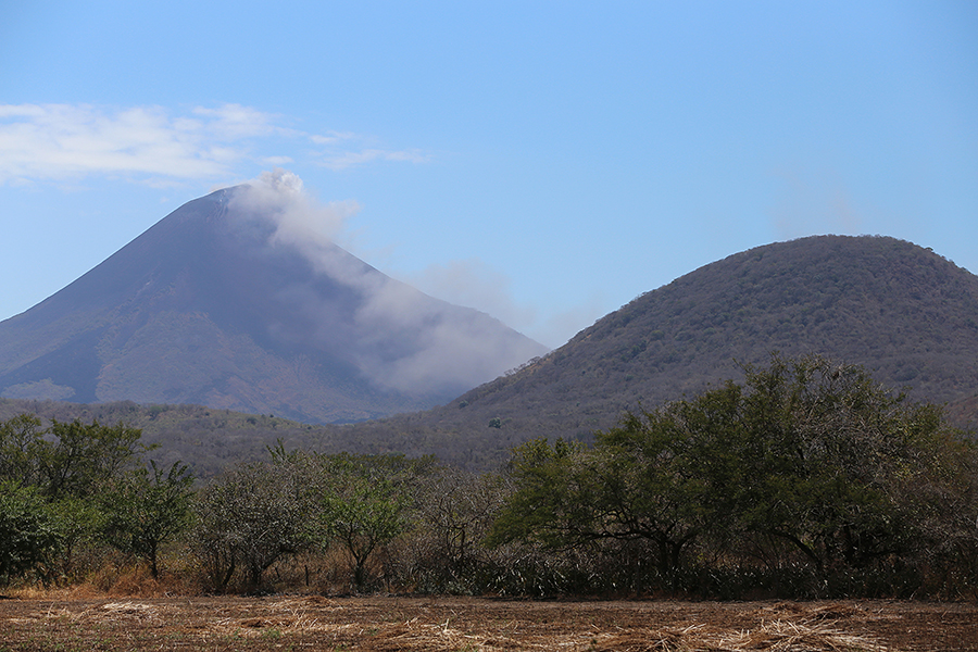
Regular steam emissions

Vigorous steam venting phase
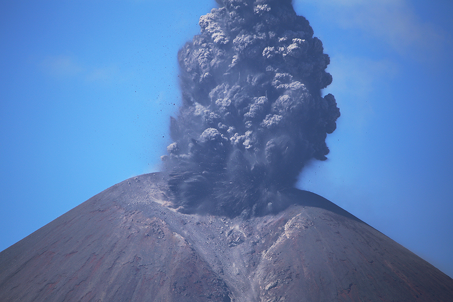
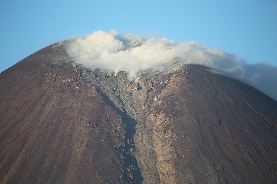
Minor ash emissions


Beginning of ash-rich strombolian eruption, Momotombo volcano Ash-rich strombolian eruption, Momotombo volcano


Ash cloud from Momotombo volcano Portrait orientation image of Momotombo volcano erupting Eruption with ash cloud, Momotombo volcano, Nicaragua

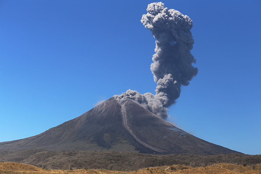
21.02.2016 morning eruption


Minor ash venting, Momotombo volcano, view from north Momotombo volcano viewed from West View of Momotombo volcano over Lake Managua

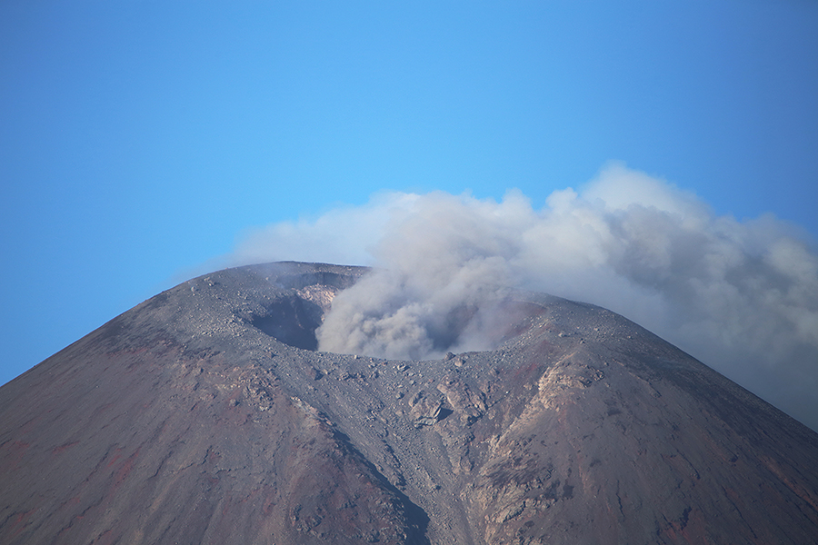
Minor ash venting viewed from north

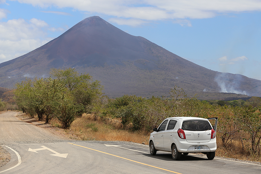
View to Momotombo from west, road to Power Station

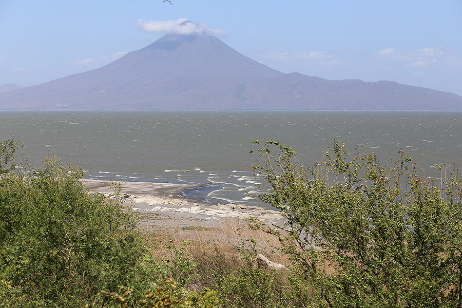
View from west coast of lake Managua to Momotombo


Visitor Information


Momotombo volcano is located about 2 hours drive from the capital Managua. Although the main road north along the west side of lake Managua is in excellent condition, as soon as one turns off the road to the east towards the volcano, one is confronted with rough dirt tracks and a total lack of road signs. Good maps or navigation programs are then important. It is in places difficult to distinguish public roads from private roads which may at some point be gated and thus not passable. Whilst tourism is already the number two economic sector in Nicaragua and regular tourists are unlikely to encounter many problems travelling in this interesting destination, we were repeatedly warned that taking photos of the volcano at night exposed us to a significant risk of armed robbery.

Further, whilst the infrastructure in Managua is modern, the area around Momotombo volcano, especially the eastern side most suitable for observing activity is poorly developed with no supermarkets or tourist accommodation in the vicinity.

The Ruins of Leon Viejo, partially preserved by burial in volcanic ash, are now a UNESCO World Heritage site and can be visited near the current settlement of Puerto Momotombo.

Nicaragua visitors can visit a large number of potentially active volcanoes, in particular Masaya volcano located just south of Managua is frequently visited.


Dust tracks near Momotombo

Private road near Momotombo volcano

Police escort approaching Momotombo

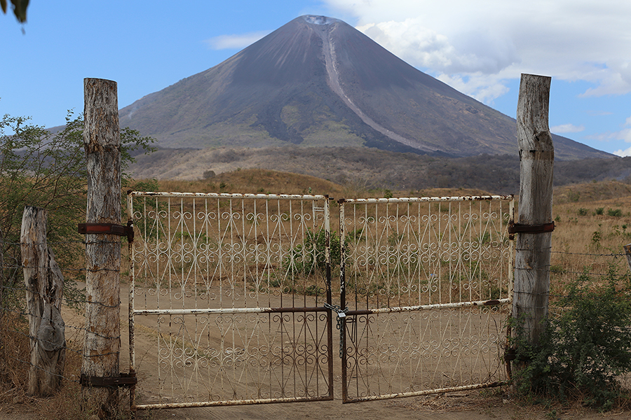
Closed gate on pivate road near Momotombo


Photovolcanica Full Index